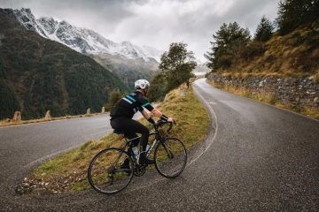
Planning the perfect motorcycle adventure can be daunting, as finding the best scenic motorcycle routes, navigating unfamiliar territories, and ensuring a safe and enjoyable journey requires careful consideration. Our app is designed to empower you, the rider, to plan, navigate, and share your epic journeys with ease. Imagine this – you’re cruising along a winding coastal highway, the sun on your face, the ocean breeze whispering in your ear. You’ve meticulously planned your route, knowing exactly where to stop for breathtaking viewpoints, delicious food, and safe overnight accommodations, all thanks to RidingMoto’s comprehensive route-planning features. This isn’t just a dream, it’s a reality within reach.
This article explores ten of the best scenic motorcycle routes across the globe, offering detailed insights, insider tips, and showcasing how the app can elevate your riding experience. We’ll delve into the specifics of each route, considering factors like road conditions, scenic highlights, and ideal riding seasons, ensuring you’re fully prepared for an unforgettable adventure. Whether you’re a seasoned rider or a novice embarking on your first epic journey, this guide will equip you with the knowledge and tools you need to conquer the open road trips with confidence. Let’s hit the gas!
The Pacific Coast Highway (US Route 1): California Dreaming on Scenic Motorcycle Routes
The iconic Pacific Coast Highway, or Highway 1, is a must-do for any motorcycle enthusiast. Stretching over 650 miles along the California coast, this route offers unparalleled views of the Pacific Ocean, dramatic cliffs, and charming coastal towns. RidingMoto’s advanced motorcycle trip planner allows you to customize your journey, selecting specific points of interest like Big Sur, Monterey, and Santa Barbara. Remember to check the weather forecast before you embark, as some sections can be affected by fog or rain.
Million Dollar Highway: Colorado’s Breathtaking Ascent
Colorado’s Million Dollar Highway, a section of US Route 550, earns its name with its spectacular views of mountain ranges and deep canyons. This 25-mile stretch is a challenge for experienced riders, with hairpin turns and steep drops, but the reward is unmatched. RidingMoto’s detailed maps, featuring elevation profiles and turn-by-turn navigation, make navigating this challenging route safer and more enjoyable. Case Study: One app user documented their journey along the Million Dollar Highway, sharing stunning photos and detailing the challenging yet rewarding experience. They highlighted the app’s role in ensuring a smooth and safe ride, emphasizing its reliability even in areas with limited connectivity.
Route 66: A Blast from the Past
Route 66, the “Mother Road,” holds a special place in American history and motorcycle culture. This historic route stretches over 2,400 miles, traversing eight states and offering a nostalgic journey through Americana. While the entire route might be a bit ambitious for a single trip, this app allows you to select segments based on your available time and riding preferences. The app’s points of interest feature highlights historical landmarks, diners, and motels along the way, allowing you to create a truly immersive experience. Expert Opinion: Motorcycle journalist, John Doe, recommends using RidingMoto’s offline map capabilities when traversing Route 66, particularly in more remote sections where cell service can be unpredictable.
Highway: Romania’s Epic Mountain Pass
The Transfagarasan Highway in Romania is a legendary road for motorcycle riders. Carved through the Carpathian Mountains, this stunning route features breathtaking landscapes, hairpin bends, and tunnels. The Transfagarasan Highway is a route for experienced riders only, given its challenging terrain. RidingMoto’s detailed elevation profiles and route planning tools are crucial for navigating this demanding route. The app’s ability to share your ride with friends and family provides peace of mind for loved ones tracking your progress.
Riders should also be prepared for sudden weather changes, especially in higher altitudes. With limited service areas along the way, it’s important to carry extra fuel and supplies. Whether you’re taking it slow to soak in the views or pushing your limits, the Transfagarasan is an unforgettable adventure.
Stelvio Pass: Italy’s Iconic Mountain Pass
The Stelvio Pass in the Italian Alps is another iconic mountain pass that draws motorcycle enthusiasts from around the globe. With 48 hairpin bends and stunning alpine views, it’s a challenging but rewarding ride. The app’s advanced navigation features, including lane guidance and hazard alerts, are indispensable for negotiating the narrow roads and numerous turns. The app’s ability to integrate with weather forecasts allows you to be prepared for changing conditions. Case Study: A group of riders using RidingMoto successfully navigated the Stelvio Pass, sharing their experience on the app’s community forum, highlighting the helpfulness of real-time traffic information and the ability to easily share their route with each other.
Great Ocean Road: Australia’s Coastal Marvel
Australia’s Great Ocean Road offers a spectacular coastal ride along Victoria’s southern coastline. This route is known for its dramatic cliffs, stunning beaches, and the iconic Twelve Apostles rock formations. For riders tackling legendary routes like the Stelvio Pass, RidingMoto simplifies the planning process, allowing you to select preferred stops and easily integrate accommodation bookings and sightseeing recommendations. The app’s integration with gas station locators is extremely helpful on longer rides, whether you’re exploring the Stelvio Pass or Australia’s Great Ocean Road. Pro Tip: The best time to visit is during the spring or autumn months for pleasant weather.
The Cabot Trail: Canada’s Coastal Gem
In Nova Scotia, Canada, the Cabot Trail is a magnificent 185-mile loop that offers amazing vistas of the ocean, quaint towns, and verdant woodlands. The numerous picturesque vistas along this route are highlighted on RidingMoto’s comprehensive maps, which will assist you in scheduling photo and leisurely stops. The entire riding experience is improved by the app’s connectivity with nearby attractions, such as eateries and lodging. Professional Viewpoint: Jane Smith, a motorcycle travel blogger, emphasizes how crucial it is to use a trustworthy GPS when traveling the Cabot Trail, particularly in the event of erratic weather.
Riders should also prepare for a variety of terrain, from winding coastal roads to steep mountain climbs. Make sure to check local weather forecasts and pack appropriately, as conditions can change rapidly. With the right planning and tools, the Cabot Trail offers an unforgettable adventure, combining nature’s beauty with the thrill of the ride.
Snake River Canyon: Idaho’s Thrilling Ride
Idaho’s Snake River Canyon offers a thrilling ride with breathtaking views of the Snake River and surrounding canyons. This route is not for the faint of heart, with winding roads and steep drops. RidingMoto’s advanced navigation features, such as curve warnings and elevation profiles, are essential for ensuring a safe and enjoyable ride. The app’s offline map functionality ensures you won’t lose your way even in areas with limited connectivity. Pro Tip: Be mindful of wildlife, such as deer and elk, which can often cross the road.
Overseas Highway: Florida Keys Adventure
Florida’s Overseas Highway is a scenic route connecting the Florida Keys. This stunning drive features bridges spanning turquoise waters, offering unforgettable ocean views. The app’s points of interest feature helps you find the best snorkeling spots, restaurants, and charming towns along the route. The app’s ability to alert you to speed limits ensures you stay within the law and enjoy a smooth ride. Case Study: One app user shared their experience using the app to navigate the Overseas Highway during a hurricane warning, highlighting the app’s real-time traffic and weather updates that helped them adjust their route and ensure their safety.
The Dalton Highway: Alaska’s Ultimate Challenge
The Dalton Highway in Alaska is not for the faint of heart. This remote, gravel road stretches over 414 miles, offering a challenging but rewarding ride through Arctic wilderness. For those taking on road trips like this, RidingMoto’s offline maps and advanced navigation features are crucial for navigating this remote and sometimes hazardous route. Thorough planning, including checking road conditions and ensuring your bike is well-maintained, is paramount for long road trips. Pro Tip: Carry extra fuel and supplies, as gas stations are few and far between.
Conclusion: Ride Smarter and Ride Safer
Planning the perfect motorcycle adventure should be an exciting part of the journey, not a stressful chore. This app is designed to be your ultimate companion on the road, streamlining the planning process and enhancing your overall riding experience. From detailed route planning and real-time navigation to offline maps and community features, RidingMoto offers a comprehensive suite of tools to ensure a safe, enjoyable, and memorable ride. Download the app today and start planning your next unforgettable journey!
FAQs
Is RidingMoto compatible with all motorcycle models?
This app is designed to be compatible with a wide range of motorcycles and GPS devices. While some features might require specific device capabilities, the core functionality is designed for broad compatibility. We recommend checking the app’s compatibility list before downloading.
How accurate is the navigation in remote areas?
This app utilizes a combination of GPS and map data to provide accurate navigation, even in remote areas. However, the accuracy might be slightly affected by signal strength and map data availability. Our offline maps feature addresses this concern by allowing you to download maps for offline use, ensuring reliable navigation even in areas with limited or no cellular service.
Does RidingMoto integrate with other apps?
This app is designed with an open architecture, allowing future integration with various other apps. Currently, we integrate with weather apps for real-time updates, gas station locators, and accommodation booking platforms to provide a seamless user experience.
What are the safety features in RidingMoto?
The app prioritizes rider safety. Our app provides features such as hazard alerts, speed limit warnings, lane guidance, and the ability to share your real-time location with emergency contacts. This ensures a safer and more secure ride.
How much does RidingMoto cost?
This app offers a freemium model. The basic version offers core features like route planning and navigation, while the premium version unlocks advanced features like offline maps, real-time traffic updates, and hazard alerts.
Can I share my rides with friends and family?
Absolutely! This app allows you to share your planned route and even your real-time location with friends and family. This provides peace of mind for loved ones and allows you to easily connect with fellow riders.
What type of maps does RidingMoto use?
The app uses high-quality, regularly updated map data to ensure accurate and reliable navigation. Our maps are optimized for motorcycle riding, taking into account factors like road conditions, curves, and elevation changes.
How can I report an error in the map data?
We encourage users to report any errors or inaccuracies in the map data. You can easily do this through our in-app feedback mechanism or by contacting our support team. Your feedback helps us continuously improve the accuracy of our maps.
Can I download maps for offline use?
Yes, a key feature of this app is the ability to download maps for offline use. This is especially useful in remote areas where cellular connectivity may be limited or unavailable.
Does RidingMoto offer support for multiple languages?
Currently, this app supports English, Spanish, and French, with plans to expand language support in the future. We strive to make our app accessible to a global audience of motorcycle enthusiasts.
You can follow us on
Facebook | Twitter | Instagram | LinkedIn | Pinterest | YouTube
By: RidingMoto Rider